
|
|
| |
|
|
|
|
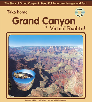
Take Home Grand Canyon in Virtual Reality DVD looks like.
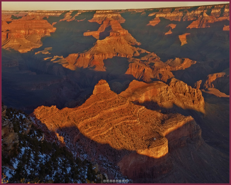
of the Toroweap section of the Grand Canyon. |
|
|
|
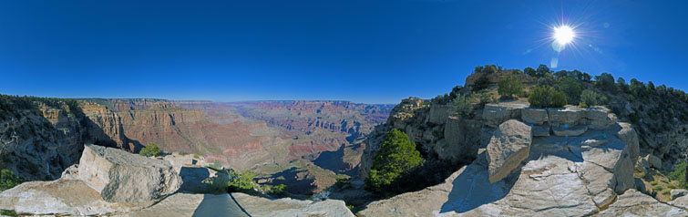
 Click to open a 360 degree view from Yaki Point just above the South Kaibab Trail on south rim of the Grand Canyon. I shot this image on January 26, 2011 on a recent trip to the Canyon. I used a Nikon D200 and shot using bracketed sequences of 7 images .7 f stops apart. The entire 360 degree composite image viewed in the panorama is a combination of 259 ten megapixel images! This photographic technique, which is explained in detail here is the only way to capture detail in both the sunlit and shadowed parts of the Canyon at this time of the morning. |
|
TAKE HOME GRAND CANYON IN VIRTUAL REALITY!
This CD contains 88 incredibly detailed hi-res 360 degree QuickTime Virtual Reality panoramic images of Grand Canyon from the rim to the river from Glen Canyon Dam on the east to Quartermaster Point on the west, including the Kaibab Plateau from the North and South Rims, The Painted Desert, the Havasupai Indian Reservation and more.
 Click to open a 360 degree view from Moran Point along the eastern part of the south rim of the Grand Canyon. Includes an entire library of rare Grand Canyon literature including John Wesley Powell's original 1875 Exploration of the Colorado River of the West and Its Tributaries, with the original woodcuts by Thomas Moran, Frederick S. Dellenbaugh's A Canyon Voyage, Clarence E. Dutton's Tertiary History of the Grand Canyon, Ellsworth Kolb's Through the Grand Canyon from Wyoming to Mexico, and other writings. |
|
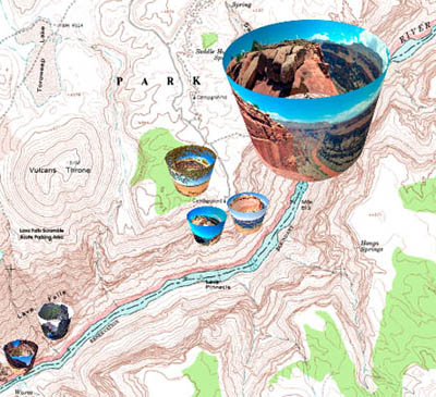
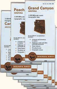
Nine USGS 1:100 000-scale Topographic Maps are included in their entirety: [Cameron, Fredonia, Glen Canyon Dam, Grand Canyon, Littlefield, Mount Trumbull, Peach Springs, Tuba City, and Valle]. The maps are linked to the panoramic images. Find a star on the map, click on the star, and it will open a panoramic view of of the place. These maps alone are worth more than the price of this CD! In addition there are 27 7.5 minute USGS topo maps in high resolution PDF format which cover the main Grand Canyon, Havasu and Toroweap areas. These digital maps are in easy to use PDF format and would cost at least $8 each if bought from the USGS or your local sporting goods store or bookstore. |
|
Also includes complete pano illustration and topo map coverage of the North and South Kaibab Trails, the Bright Angel Trail, the New Hance Trail, the Lava Falls Scramble.
Download the User Manual for a complete listing of the contents of "Take Home Grand Canyon in Virtual Reality."
Over 1,850 exposures were used in creating the images on this disc. Cameras included a Nikon D200 digital SLR, Nikon N-65, N-70 and N-90 35 mm film cameras, and Mamiya RB-67 medium format film cameras.
 Click here to download the User Manual in PDF format. (Includes Table of Contents) 2.7 meg. |
|
|
|
|
|
|